The Californian landscape is nothing short of spectacular. It has a little bit of everything, from snowcapped mountains to deep-lying valleys and stunning beaches to vast desert terrain. Mountain ranges in California are scattered throughout the state, occupying the northern, southern, and central areas. The entire collection of rugged peaks is known simply as the California ranges.
Over 350 mountain ranges are made up of almost 1,800 named peaks. The east coast is home to the famous Cascade range and the Sierra Nevadas, which have long been a favorite among tourists, climbers, and those seeking a break from city life. The continental shelf on the state’s west coast is shaped by the North American Coast and Southern Coastal ranges.
Among the most famous and popular ranges in the Golden State are the California Coast, Transverse, and Peninsular ranges. These mountains are symbolic of California’s topography, offering endless hypnotic scenery.
Each range offers something different. However, you’re guaranteed to find jagged crests, rolling hills, flawless lakes, and thunderous waterfalls. No California trip is complete without setting your eyes on at least one of its impressive ranges.
California Mountain Ranges
With so many mountain ranges in a single state, it can be difficult to contextualize California’s diverse terrain. The best way to dissect the region’s scope is to divide it into the north, south, and central territories. However, it’s also important to note that the primary ranges are divided into three sub-systems, which we’ll discuss later.
One of the greatest appeals of California’s many mountain ranges is accessibility. Most can, at least partially, be reached by car via major roadways.
Moreover, the weather along the east coast is some of the best in the United States. No matter what time of year you visit, there is plenty to see and do. Winter provides great opportunities to ski, hike, and photograph snowcapped mountains.
Spring and fall offer pleasant conditions to explore the eclectic landscape. While summer can get hot, a little planning and organization ensure you can avoid the highest temperatures and the occasional thunderstorm.
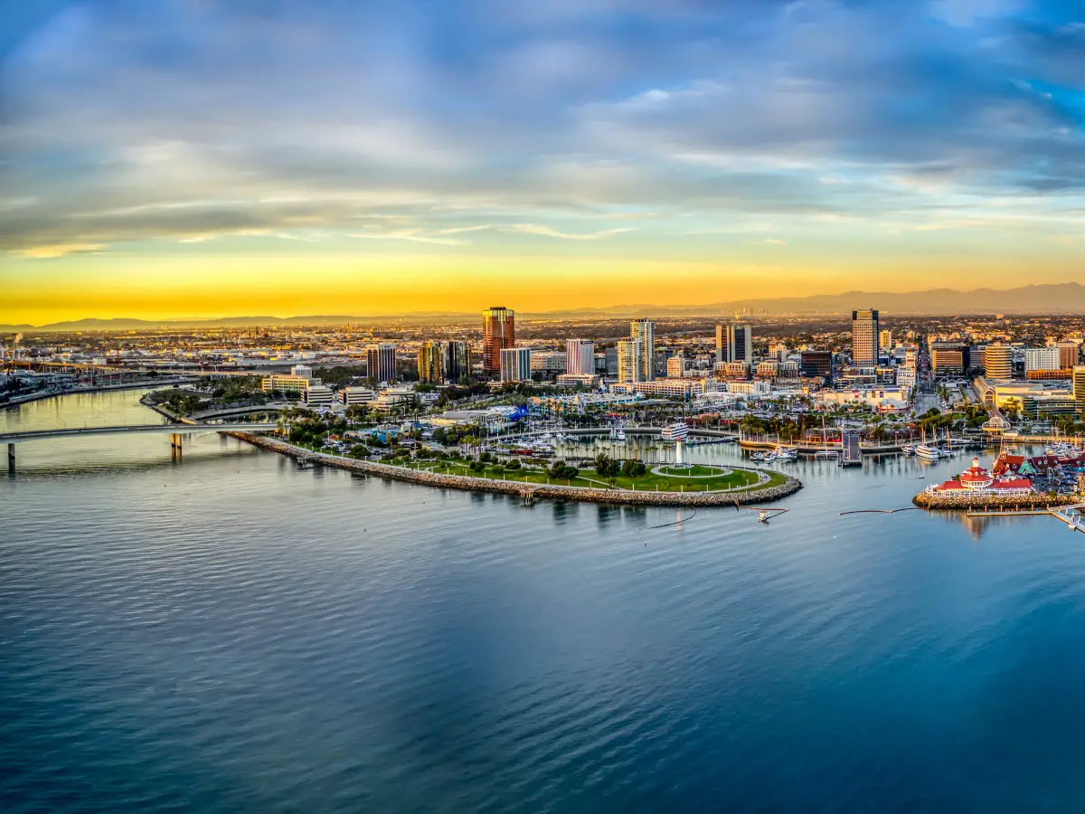
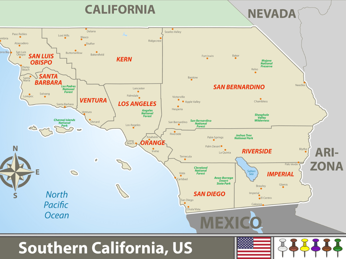
Southern California Mountain Ranges (with Map)
The south of California has the largest accumulation of mountain ranges, with many sections of the core sub-systems occupying at least some part of the region. Some of the most well-known ranges in the area include the San Bernardino Mountains and the San Jacinto Mountains.
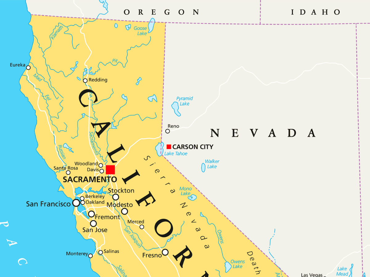
Northern California Mountain Ranges (with Map)
North California also has several notable mountain ranges alongside national parks and key landmarks. Some extremely popular and important mountains form part of the northern landscape, including the Cascades, the Klamath Mountains, the Diablo Mountains, and the Santa Lucia Mountains.
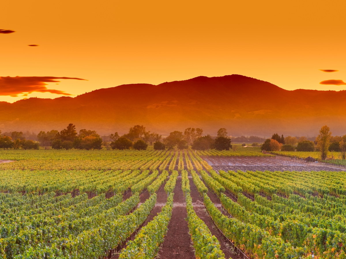
Central California Mountain Ranges
Many of the central California Mountain ranges also flow into the northern and southern regions of the state, including the Santa Lucia and Diablo Mountains. The highest summit in the central ranges is Junipero Serra Peak which reaches 5,862 feet.
California Moutain Ranges: The Primary Systems
The primary California mountain ranges are categorized into three distinctive sub-systems: the California Coast, Transverse, and Peninsular. These mountains are made up of different geological structures and ecosystems. Each range’s looks, flora and fauna, and notable landmarks are unique.
California Coast Ranges
The California Coast ranges extend the entire length of the state, beginning in the north and continuing along the ocean’s edge to the Mexican border. Some of the main ranges within these clusters are the Santa Lucia range and the Northwest US Coast range. The California Coast mountains are formed mainly from Jurrasic, Tertiary, and Cretaceous rock.
These rocks were created over millions of years as layers of materials, rocks, fossils, and minerals compacted over each other. Some mountains were also developed as part of the Mesozoic-age Franciscan formation.
The Franciscan Complex occupies much of coastal central and southern California. Interestingly, several fossils and microfossils were found in this area, including:
- Ichthyosaurus: the fish-lizard of California
- Franciscanus: the fish-lizard of Franciscan
- Hesternus: one who is near to being a lizard of the West Coast
These skeletal figures dated back to the Jurassic period and were believed to be approximately 11 feet long. California’s wildlife has always been eclectic, even in the days when the dinosaurs roamed.
Transverse Ranges
The Transverse ranges are located in southern California and are one of the more diverse collections of mountains in the entire country. These mountains are easily accessible from popular SoCal regions like Santa Barbara, L.A., Ventura, and San Bernadino. The Transverse ranges run east to west and are surrounded by the San Joaquin and Antelope Valleys, near the L.A. Basin.
The Transverse ranges get their name from their orientation. The east to west trajectory means that they are transverse to the northwest-southeast orientation of most coastal mountains. You may not know that the Transverse ranges extend beyond the west coast of California and have formed the Northern Channel Islands near Santa Rosa and San Miguel Island offshore from Santa Barbara.
Spanning approximately 300 miles laterally, the Transverse ranges suddenly end with a dramatic drop into the Colorado and Mojave deserts. This makes for incredible views and photograph backdrops for visitors.
One of the most interesting aspects of the Transverse mountains is the variety of mountain rocks. The western ranges are made predominantly from sedimentary rocks, which combine to create unique folds, twists, and shapes along the jagged peaks.
The eastern shelf contains a lot of metamorphic and granitic rocks. Some of the largest mountains within the Transverse ranges include:
- Santa Ynez Mountains
- San Emigdio Mountains
- Sierra Pelona Ridge
- Topatopa Mountains
- Pine Mountain Ridge
- San Gabriel Mountains
- Little San Bernardino Mountains
- San Bernardino Mountains
Peninsular Ranges
The Peninsular ranges stretch north to south from southern California through the Baja California Peninsula in Mexico. They are approximately 900 miles long and are bound by the Pacific Ocean and the Sonoran Desert on either side. The notable mountain groups within the Peninsular range include the Santa Ana Mountains, Laguna Mountains, and the San Jacinto Mountains.
A fascinating feature of these ranges is the vegetation. It varies from deep forest to scrub, according to the elevation levels. The Palomar Observatory (San Diego) is in the Palomar Mountain range. It is a key center for astronomical research that Caltech owns.
If you visit the San Jacinto Mountains, take the cable tram. This system runs from the ground and takes you close to the peak. The 10-minute journey provides amazing landscape views, including the Chino Canyon and the State Park. Once you reach the top, you can enjoy observation decks, a national history museum, restaurants, and more than 50 miles of trails.
Cascade Range
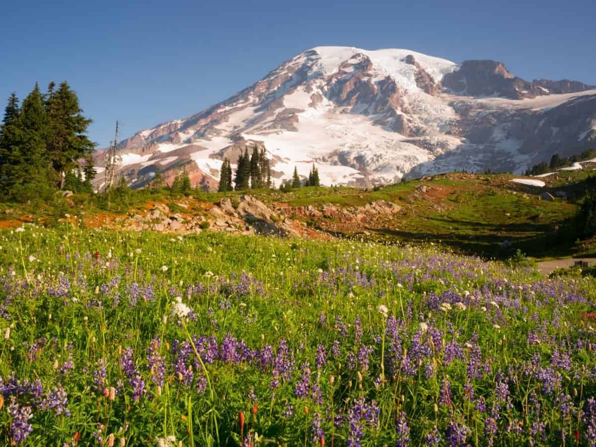
The Cascade Range forms part of the Pacific mountain system that runs north of the state. The mountains pass through other states, including Oregon and Washington, and connect to the Fraser River in British Columbia, Canada. These ranges have many steep peaks above 10,000 feet, such as Mount Rainier (14,410 feet) and Mount Hood (11,235 feet).
The Cascades are popular due to the heavy presence of forest land and breathtaking nature. Virtually all of the range is covered in woodland and national forests. It is also one of the wettest mountain ranges in California, accumulating up to 100 inches of rain annually. This contributes to the plush greenery and dense forest.
In the North Cascades, you can find many beautiful lakes, many of which have unusual features due to their volcanic origins. Some of the most picturesque landmarks include Crater Lake, Lessen Volcanic National Park, and the Lava Beds National Monument. The variety of natural resources means hydroelectric power and irrigation are the main industries in the area.
The sheer size of the Cascades provides enough landscape for several lifetimes of exploration. If you’re planning a visit, Mount Rainier is one of the main highlights, with hundreds of hiking trails, climbing routes, and the national park.
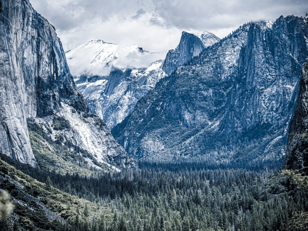
What is the Highest Mountain in California?
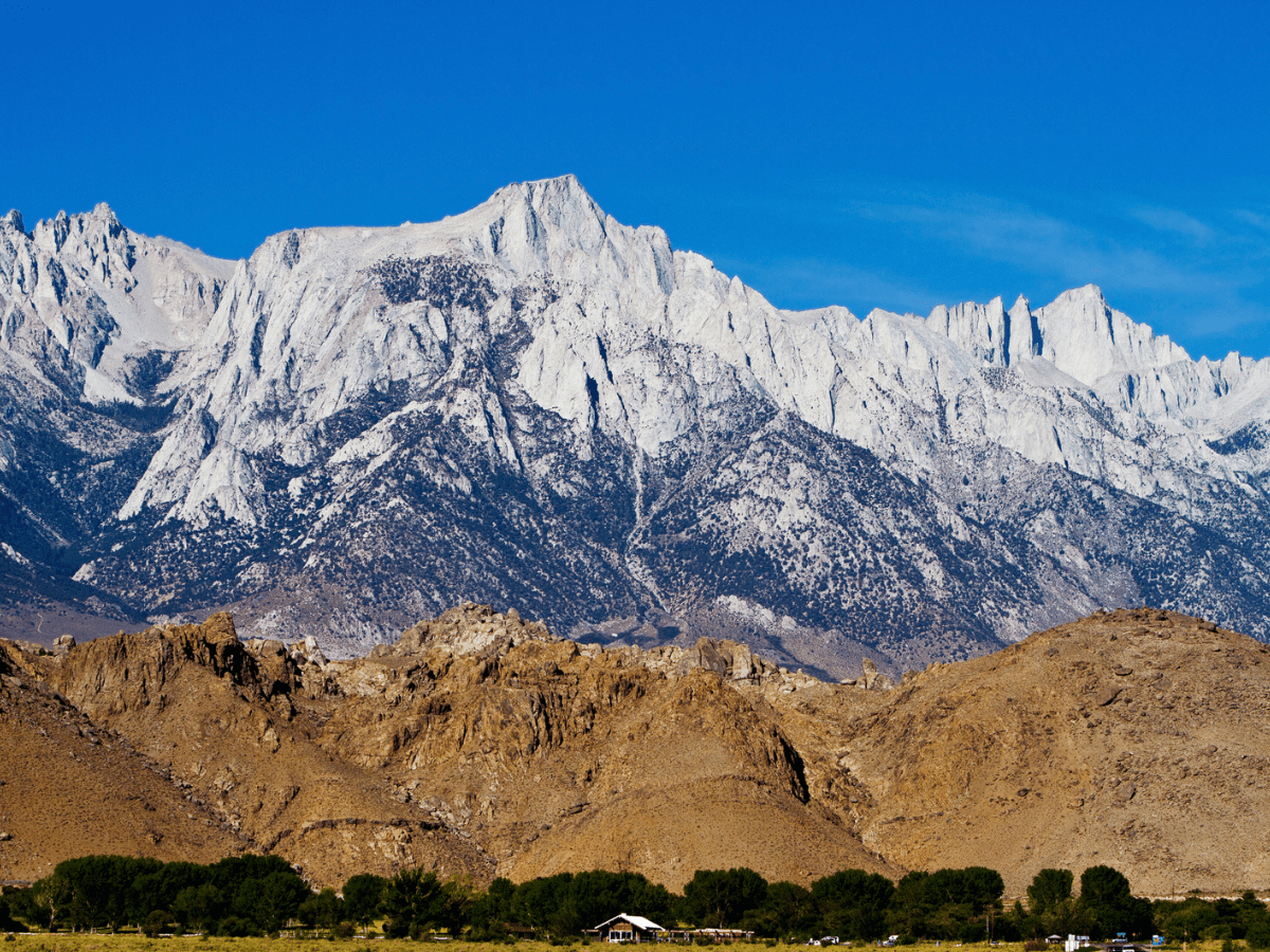
The highest mountain in California is Mount Whitney, which is nestled in the Sierra Nevadas. Mt. Whitney is the highest peak in the contiguous United States, with an elevation of 14,505 feet. It is an extremely popular mountain for hikers, climbers, and general visitors.
The famous Sequoia National Park is located along the mountain’s western slope, attracting over a million sightseers annually. The park is also the southern terminus of the John Muir Trail, which is a challenging but extremely popular hiking route. Mt. Whitney was formed along with the Sierra Nevada Batholith.
Much like the rest of the Sierra Nevadas, the mountain is made up of large chunks of granite. Over millions of years, Mt. Whitney and the highest peaks of the Sierras have been stripped away by erosion, revealing multiple layers of dense granite. This is one of the primary reasons it is so popular among climbers, who often favor these firm, igneous formations.
Climbing and Exploration
The first recorded ascent of Mt. Whitney was in 1873. It was summited by Charles Begole, A. H. Johnson, and John Lucas. They named it Fisherman’s Peak. However, its official name was given nine years previous by members of the California Geological Survey. The peak is named after Josiah Whitney, a State Geologist in California and a financial contributor to the California Survey.
Today, around 30,000 climbers attempt to reach the summit every year. However, only a third reach the peak. While it’s not seen as a particularly difficult climb among elite-level mountaineers, Mt. Whitney isn’t a cakewalk. It poses several challenges, including high altitude conditions and technical climbing spots.
There are multiple ways to tackle the summit. The John Muir Trail is one of the most popular routes as it allows hikers to reach the top on foot without climbing steep rock faces. It’s mandatory to obtain a permit to complete the ascent as your route crosses National Park territory. Trail camps are scattered along the route, so you can camp overnight to break up the journey.
Climbing Mt. Whitney is an extremely rewarding journey. The entire voyage gifts spectacular views from all angles, allowing you to overlook the many valleys, forests, and nearby peaks. However, it’s important to note that the altitude can significantly impact your endurance, especially if you make the ascent over multiple days.
Hiking Trails
Located in the heart of the Sierras, you can take your pick from the region’s vast array of world-class hiking trails. The Mt. Whitney Hike takes you to the summit. If you’re looking for a more casual hike, consider the nearby Lone Pine Lake Hike, the Red Mountain Hike, or a stroll through Yosemite. All of these locations offer stunning views of the great mountain.
Perhaps the most famous trail in the region is the John Muir Trail (JMT). This backpacker route can be completed partially along its numerous sections or in its entirety over three weeks (on average). The trail covers 211 miles of terrain and includes 13,000 and 14,000-foot peaks.
One of the main appeals of the JMT is its accessibility. Large sections are easy to complete. What’s more, the region is known for its excellent year-round weather. You’d be hard-pressed to find a more pleasant trek among the world’s most well-known mountains.
California’s Other Major Peaks
Mt. Whitney is the highest peak in California, but just about. Several summits go above the 14,000 feet mark. Some of the other major peaks in the state include:
- Mount Williamson: 14,379 feet
- White Mountain Peak: 14,251 feet
- North Palisade: 14,248 feet
- Mount Shasta: 14,179 feet
- Mount Humphreys: 13,992 feet
- Mount Keith: 13,992 feet
California Mountains FAQs
How many mountain ranges are in California?
There are 352 mountain ranges in the state of California, ware well-known mountains and peaks in every direction. Many ranges have different formation histories, resulting in various rock types and a highly diverse landscape.
What are the 3 mountain ranges in California?
While there are many mountain ranges in California, they are frequently categorized into three broad ranges: the California Coast, Transverse, and Peninsular ranges. Sub categorizing mountain ranges makes it easier to understand the scope of these ecosystems within the state fully.
References