How long is California if you want to travel from one end to the other? A commonly used geographic estimate is about 770 miles, but that is not the same as a driving route or a coastline measurement. Those differences matter when a map makes a long journey look like a simple north-to-south line.
California’s roads pass through cities, valleys, mountains and desert, and the route you choose determines the distance and time involved. Interstate 5 gives one useful border-to-border comparison, while coastal roads follow a different course. This guide explains the main measurements, places the regions on the map, and shows how geography, population and history affect a journey through the state.
How California’s Length Is Measured
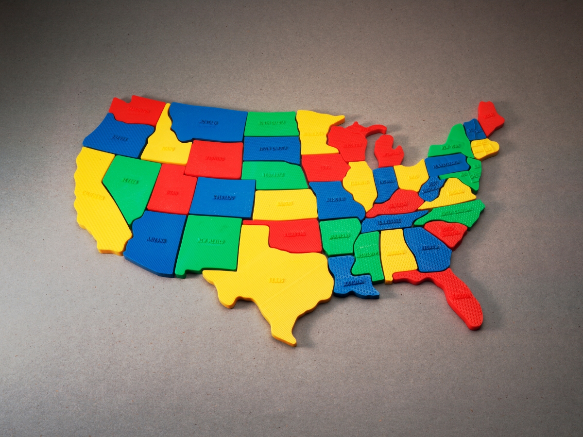
The California emergency plan’s geography overview describes the state as about 770 miles long and 250 miles wide. Treat these as broad dimensions of an irregular shape, not the sides of a rectangle. California borders Oregon, Nevada and Arizona, with the Mexican state of Baja California to the south and the Pacific Ocean to the west.
For a road comparison, Caltrans’s Interstate 5 exit list places the Oregon border at mile 796.77 from the route’s southern starting point at the Mexican border. That is about 797 road miles, before detours or sightseeing. A coastline figure measures the shore instead, so it cannot be substituted for either a geographic length or a road itinerary.
Mountains
The Sierra Nevada, Cascade Range and Tehachapi Mountains influence routes through California. Mount Whitney in the Sierra Nevada rises to about 14,505 feet, the highest summit in the contiguous United States. Mountain roads do not always connect the places nearest each other on a map. Plan around an actual pass or highway, and check its seasonal access rather than assuming a direct crossing.
Deserts
California’s southeastern deserts include the Mojave and the Colorado Desert, which is part of the wider Sonoran Desert. Desert regions extend beyond state boundaries, so a total area quoted for the Mojave is not necessarily its area within California. For a journey, service locations, heat and the distance between stops are more useful than a broad desert-area figure.
Lakes and Rivers
Lake Tahoe sits on the California-Nevada boundary, while the Colorado River forms part of California’s southeastern boundary. The Sacramento River flows through the northern Central Valley and into the delta system. Lakes, rivers and reservoirs help explain settlement and water supply, but they also affect routes: a crossing, shoreline road or boat access point may be far from the nearest place in a straight line.
Pacific Coast
The California Coastal Commission describes about 1,100 miles of coastline. Other coastline totals use different methods, particularly around bays, headlands and islands. Big Sur and the Santa Monica Mountains illustrate the varied terrain beside the ocean. A coastal drive follows roads through that terrain and is not equal to the shoreline’s measured length.
Metropolitan Areas
Los Angeles, the San Francisco Bay Area, San Diego and San Jose are major urban destinations. They are also travel regions whose extent can be much larger than a city boundary. Crossing a metropolitan area may take substantial time without covering many miles. Check the address of the specific neighborhood, attraction or overnight stop instead of relying only on the nearest famous city name.
Counties
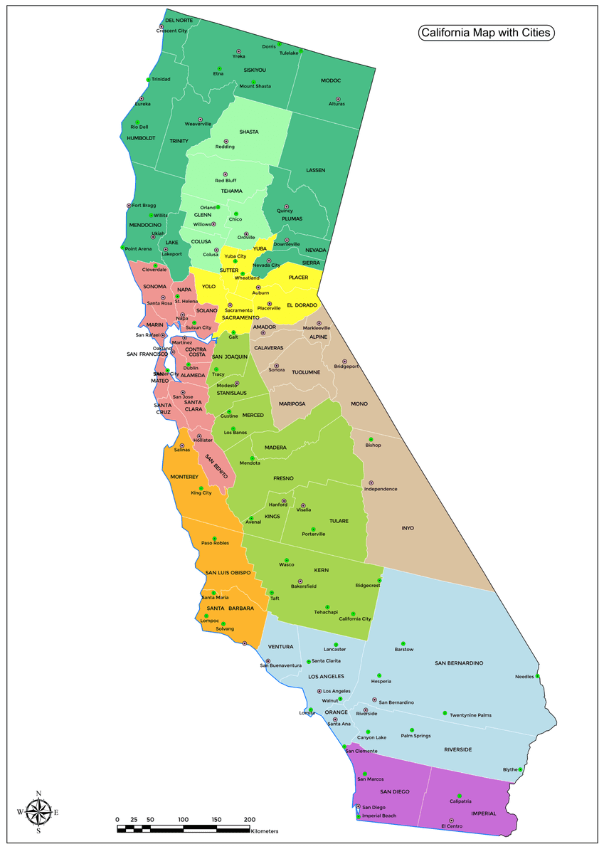
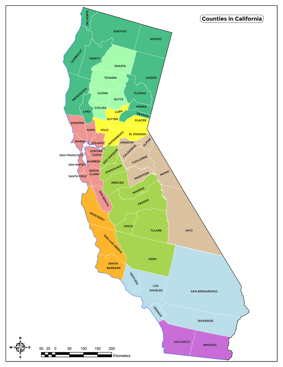
California has 58 counties. A California counties map helps locate places such as Kern, Monterey, Orange, San Bernardino, Santa Barbara, Shasta and Sonoma. Counties differ greatly in size and terrain, so crossing one county is not a standard unit of distance. A county label is useful for orientation, but a route still needs actual destinations.
National Parks
Yosemite and Sequoia are two of California’s best-known national parks. Their entrances, accommodation areas and major sights are spread out. A park boundary on a map does not tell you how long it takes to reach a valley viewpoint or a sequoia grove. Check the particular entrance and attraction when estimating a travel day.
To plan a trip through California, first select the regions you want to see, then connect a small number of specific stops. Compare the resulting road route with the time available. Adding sightseeing, meals and overnight stays turns a distance calculation into a realistic itinerary, especially when a long day includes city traffic or mountain access.
State Borders and Government
The state is governed from Sacramento, but cities, counties and other public agencies manage many local services and roads. California’s length and regional differences mean that transport, water and land-use questions affect communities differently. A statewide political description will not tell you who manages a particular beach, road, trail or local facility.
State Capital
Sacramento is the state capital, located inland in the northern Central Valley. The Capitol area, Old Sacramento and railroad history provide ways to explore its role in state government and travel. It is a distinct destination rather than the geographic midpoint of every California route. Check its position against your itinerary before assuming it is a convenient halfway stop.
Political Status
California entered the Union on September 9, 1850, as the thirty-first state. Its admission as a free state was part of the Compromise of 1850, which also included a stronger federal fugitive slave law. Statehood established its position within the United States; it did not erase the conflicts over race, land and political rights within California.
The southern land border is with Baja California, which is part of Mexico. Baja California is not a separate country on California’s western side. A journey entirely within California differs from one crossing the international border, so keep the destination and border crossing clear when reading maps or planning transport.
California’s voting arrangements also require precise descriptions. The Secretary of State’s Motor Voter program covers eligible applicants completing specified DMV transactions unless they opt out. It does not automatically register every resident regardless of eligibility. State policies should be checked against the agency responsible rather than reduced to broad claims about political progress.
For travelers, the most useful political boundary is often the one identifying the responsible authority. A state highway, federal park and municipal beach may publish information through different agencies. Use the managing authority’s current access guidance when planning a stop, even when all the places sit within the same county or travel region.
The Industries Along California’s Travel Corridors
California’s economic activity is spread across several regions and industries. In an April 2026 release citing BEA data, the state reported nominal GDP of about $4.25 trillion for 2025. That measures the value of output, not residents’ wealth. A long journey crosses different parts of this economy, from farm regions to ports and technology centers.
Agriculture
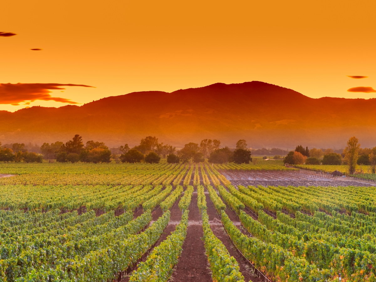
The Central Valley includes the Sacramento Valley in the north and the San Joaquin Valley farther south. Orchards, vineyards, fields and dairy operations are part of its agricultural landscape. Crops such as almonds, grapes, strawberries and lettuce also connect with other growing regions across the state. Agriculture helps explain freight movement, seasonal work and the towns along major inland corridors.
Manufacturing
Manufacturing includes activities such as aerospace, electronics, food processing and transportation equipment. These are not confined to a single industrial district. Connections among factories, suppliers, ports and distribution centers help shape road and rail traffic across California. An undated statewide percentage is less useful for understanding a route than the economic role of the places along it.
Silicon Valley
Silicon Valley refers broadly to the southern San Francisco Bay Area’s technology ecosystem, including communities such as Cupertino and Mountain View. Apple and Google are familiar examples, while Facebook is a service associated with Meta rather than the parent company’s current name. Offices and campuses are not automatically public attractions; choose a specific visitor facility or event if technology is part of your itinerary.
Different industries explain why California has several major travel corridors rather than one simple north-to-south route. Agricultural, port, manufacturing and office activity create different patterns of movement. A scenic itinerary can intersect busy commuter or freight routes, so allow flexibility around urban crossings and use current route information for the day of travel.
Historical Context
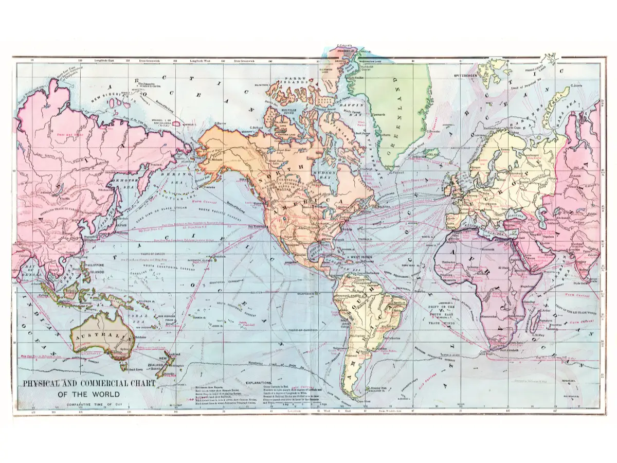
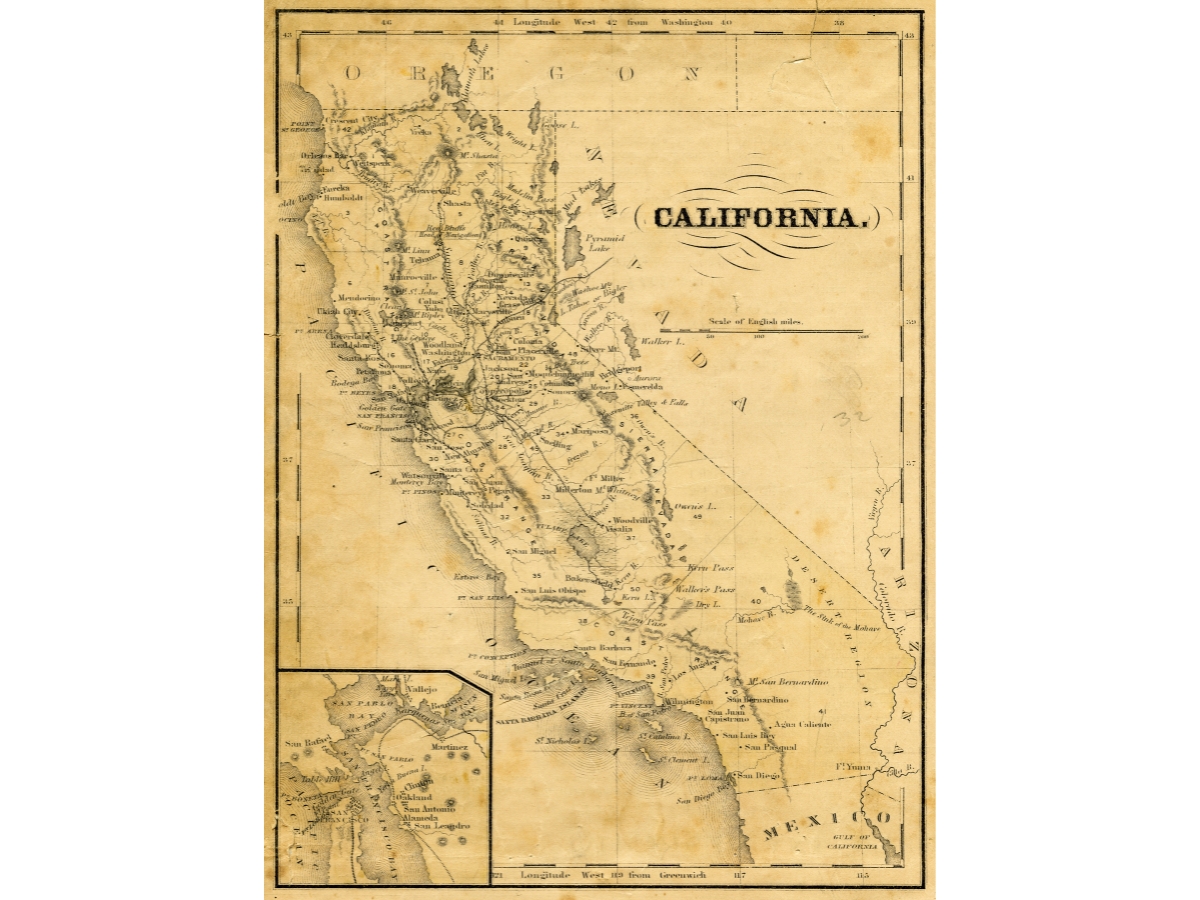
California’s present-day boundaries and roads sit over a much longer history. Native peoples established communities and connections across the region before European colonization. Spanish and Mexican rule, the Gold Rush and U.S. statehood changed settlement and land use. Historic maps can help show these changes, but they should not be treated as current navigation maps.
California Gold Rush
Gold was discovered at Coloma in January 1848, and the arrival of many fortune-seekers in 1849 gave the forty-niners their name. Marshall Gold Discovery State Historic Park explains the site and its history. Mining expanded towns, commerce and transport, while also damaging landscapes and contributing to the dispossession and exploitation of Native communities.
Spanish Influence
Spanish missions formed part of a colonial system that changed religion, labor, agriculture and land use. They introduced crops and livestock but also imposed severe disruption and coercion on Native peoples. Many places retain Spanish names, yet those names are only one layer of their history. Local and tribal interpretation can explain what existed before colonization and what continues today.
The mission at San Buenaventura was founded in 1782; that date should not simply be presented as the incorporation date of today’s city of Ventura. Mission foundations, earlier Indigenous communities and later municipal government belong to different timelines. This distinction matters when using a historical stop to understand how the towns along a modern route developed.
A long-distance journey offers opportunities to connect these histories across regions. Choose a few sites whose interpretation interests you instead of assuming every historic building tells the same story. Museums, tribal resources and local histories can add context to a map that otherwise shows only roads and settlement names.
Cultural Aspects
California’s communities differ in languages, traditions and everyday life. Coastal, inland, mountain and desert settings influence those differences, but none produces a single uniform culture. A route through the state can introduce several communities without representing all of them. Spend time in a particular place to understand more than its best-known attraction.
Film and television are closely associated with Los Angeles and the Hollywood name, although production extends beyond one neighborhood. Screen images can make different California places seem closer together than they are. When visiting a location associated with a film, verify its actual address and public access rather than assuming the scene shows the route you will follow.
California’s musical histories include rock, surf music, punk and hip-hop, which developed in different periods and communities. Coachella and Outside Lands are examples of festivals in very different settings. A performance can provide a useful anchor for a trip, but confirm the current date, venue and transport arrangements before planning other stops around it.
Food reflects farming regions, migration, coastal access and local traditions. Mexican food, seafood and California wines are familiar associations, alongside many other cuisines. Napa Valley and Sonoma are outside San Francisco, so a visit to wine country requires its own travel time. Look for food experiences near your chosen route rather than adding a distant stop solely because it is famous.
The Golden Gate Bridge, Alcatraz and Hollywood Walk of Fame belong to different cities and require different visits. The bridge is a transport crossing, Alcatraz is an island site, and the Walk of Fame is a streetside attraction. Their shared California identity does not make them suitable for one short sightseeing circuit.
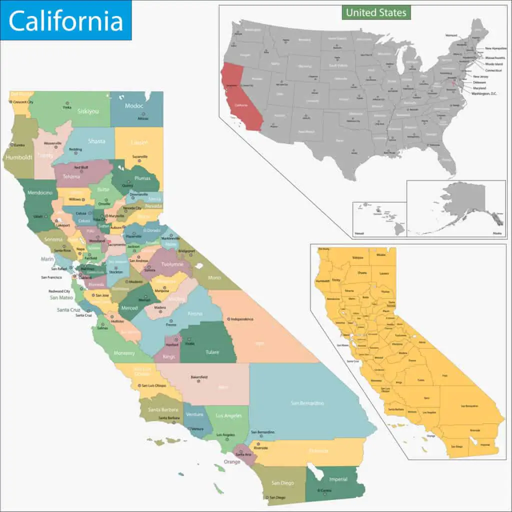
Maps and screen portrayals simplify space for different purposes. A decorative map may omit detail, while a film can compress a journey into a short sequence. For practical travel, use a current route planner with specific endpoints. For cultural context, explore the stories and images separately without expecting them to function as directions.
A useful itinerary leaves room for local experiences between the major stops. A market, museum or neighborhood walk can explain more about a place than another long transfer. The guide to what California is known for connects those interests with regions and landmarks across the state.
Climate and Natural Features
California’s climate varies with latitude, elevation, distance from the ocean and terrain. Many coastal and lowland areas have a Mediterranean pattern with relatively wet winters and dry summers, but the entire state does not share one climate. A long route can cross several weather conditions in a single day, especially when it includes a mountain pass.
The Sierra Nevada separates much of the Central Valley from the eastern side of California. Mount Whitney illustrates the range’s extreme elevation, while Yosemite and Kings Canyon contain varied mountain landscapes. A high-country destination can remain affected by snow when a nearby lowland city is warm. Check the destination’s elevation and access, not just a statewide forecast.
Badwater Basin in Death Valley lies 282 feet below sea level, the lowest point in North America. It provides a striking contrast with California’s high mountains. Summer heat makes low-elevation walking dangerous; the National Park Service’s summer guidance advises against hiking at low elevations. Treat this as a distinct environment when planning a route.
Owens Valley lies east of the Sierra Nevada and contains communities along the U.S. 395 corridor. The valley and its surrounding mountains create a different north-south journey from the Central Valley or the coast. A hot spring shown on a map is not automatically a public bathing site, so confirm ownership and permitted access before considering a stop.
The Great Basin extends across several states and includes parts of eastern California. Its defining drainage pattern is internal: water does not generally flow out to the ocean. Sagebrush landscapes, pinyon-juniper woodland and higher mountain habitats occur in different areas. It should not be confused with a single valley or with the boundaries of California itself.
California’s Golden State nickname connects strongly with Gold Rush history, but does not describe one year-round landscape. Hills can be green after rain and gold in the dry season; mountain country can be snowy. The name is a cultural shorthand, not a reliable guide to the conditions along an entire route.
The Golden Gate Bridge links San Francisco with Marin County across the entrance to the bay. It can be a landmark stop or part of a route, depending on your itinerary. Distinguish driving across it from walking, cycling or viewing it from shore. Each choice involves a different amount of time and different access arrangements.
Before departure, review the route in sections: urban crossings, mountain stretches, desert roads and the final approach to each destination. Allow room to change a sightseeing stop when conditions make it unsuitable. The length of California explains the scale of the trip, while the terrain and planned activities determine how manageable each day will be.
Population and the Distances Between Communities
The Census Bureau’s July 1, 2025 estimate put California’s population at 39,355,309. Its 2020 census counted 39,538,223. Those figures do not show uninterrupted growth, and estimates are revised over time. A dated population figure is more useful than describing the state as steadily growing without identifying a period.
California’s population includes many racial and ethnic identities. Census categories need care: Hispanic or Latino is an ethnicity that can include people of any race, while Asian and Native Hawaiian or Other Pacific Islander are separate categories. Adding overlapping percentages as though they were exclusive groups produces a misleading picture of the state’s population.
Settlement is uneven, with major urban regions separated by less densely populated farmland, mountains and desert. Los Angeles, the Bay Area, San Diego and the Inland Empire each cover more than a single downtown. Population geography affects where services, accommodation and traffic are concentrated along a journey, but metropolitan boundaries need to be defined before comparing their totals.
Age patterns also differ between communities. A statewide median or long-range projection does not tell you whether a particular town has more students, families or older residents. For comparing places to live, use current local data and a clearly dated source rather than assuming every region shares the same age profile or future growth pattern.
Census estimates for 2020-2024 report that 27.0% of California residents were born outside the United States. This reflects many individual migration histories, not one uniform community. Local museums, businesses and community institutions can help explain how those histories shaped the places along a route, beyond what a statewide percentage conveys.
For the same 2020-2024 period, 44.4% of Californians aged five and older spoke a language other than English at home, according to Census QuickFacts. That measure does not mean they could not also speak English. Languages spoken at home and English proficiency are different statistics and should not be treated as interchangeable.
California’s length, population and regional differences explain why it rewards careful route planning. Use about 770 miles as a broad geographic description and about 797 miles for the I-5 border-to-border comparison, then calculate your own journey from its actual stops. A realistic itinerary depends on roads, conditions and time in each place, not a single number.